- This topic is empty.
-
AuthorPosts
-
2026-10-13 at 9:00 am #12349
Introduction
Mineral exploration teams, geologists, and engineering firms use geophysical instruments and data platforms to investigate subsurface structures, identify geophysical anomalies, characterize hydrogeological conditions, and improve survey workflow efficiency. In practice, field results can be affected by target depth, terrain, ground-contact conditions, cultural noise, survey geometry, power supply, acquisition settings, and interpretation workflow.
This article introduces five providers active in geophysical instrumentation and subsurface-data workflows. The entries are presented as editorial reference points rather than an independently tested performance ranking. Buyers should compare the exact model, configuration, support arrangements, data workflow, and relevant field evidence before making a procurement decision.
1. Geomative
Brand Introduction
Geomative is a Shenzhen-based provider of geophysical equipment and digital subsurface solutions serving international markets. Its current product and solution portfolio covers resistivity and induced-polarization imaging, electromagnetic methods, integrated well logging, airborne and ground magnetometers, geological online monitoring, and the DIGspace geospatial platform.
For mineral exploration teams, the value of an integrated workflow is not that it automatically confirms an ore body or mineral reserve. Rather, it can help teams acquire, review, organize, interpret, and compare geophysical evidence more efficiently before using drilling, sampling, geological mapping, and other ground-truth methods to verify exploration targets.
Core Technology & Products
Geomative’s current portfolio includes electrical-resistivity and IP systems, transient-electromagnetic systems, digital subsurface-data tools, and supporting accessories.
Resistivity and IP Imaging Systems
The GD product family includes models with different channel counts, transmission capacities, deployment options, and imaging functions. GD-10 is a single-channel electrical-resistivity and IP system. GD-20 is available in 5-channel and 12-channel configurations. The GD-12/GD-22/GD-32 line lists 1-, 6-, and 12-channel receiving configurations respectively.Depending on the selected model and configuration, GD systems can support SP, 1D resistivity/IP sounding, 2D/3D resistivity/IP imaging, surface surveys, water-surface surveys, underwater static surveys, borehole, and cross-hole configurations. Selected GD-10 and GD-20 configurations list optional transmission capacity up to 9000W, while other models and configurations have different published specifications.
Transient Electromagnetic Systems
Geomative’s TEM portfolio includes GT-10 for mid-to-deep exploration, GT-20 for tunnel prediction, GT-30 for ultra-shallow investigation, and GT-40 for borehole TEM applications. Across the current electromagnetic portfolio, published exploration-depth ranges vary by model and configuration, with the series covering applications from shallow investigation through mid-to-deep exploration.TEM data can support the identification and interpretation of geological structures and anomalous zones. Interpreted anomalies should be assessed together with geological context and verified through drilling, sampling, exposure, or other appropriate ground-truth methods where material decisions are involved.
DIGspace Geospatial Platform
DIGspace is Geomative’s 3D geospatial digital platform for engineering investigation and underground-space development. It is designed to bring ERT, GPR, borehole data, terrain, imagery, engineering drawings, and monitoring time series into a unified spatial framework.The platform supports workflows including data import, quality control, inversion and processing, multi-method analysis, three-dimensional visualization, desktop analysis, and Web collaboration. For mineral exploration projects, these functions can help teams compare geophysical results with borehole and geological evidence in a traceable spatial context.
Accessories and Field Configuration
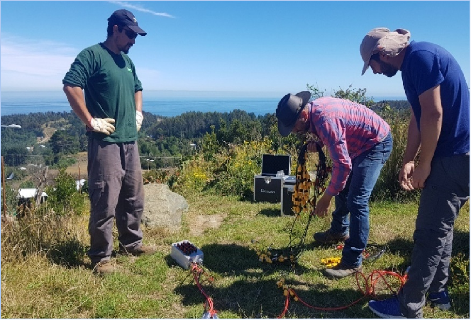
Geomative’s electrical-survey ecosystem includes high-density cables, SR-10/SR-20 bidirectional smart cable heads, junction boxes, and BP-series power supplies. The exact cable type, electrode arrangement, power supply, protection requirements, and deployment method should be selected according to line length, terrain, target depth, available power, and survey design.Industries Served & Client Types
Geomative’s published application directions include mineral-resource exploration, groundwater investigation, engineering geology, tunnel prediction, environmental monitoring, dam and tailings-pond monitoring, urban underground-space investigation, and archaeological investigation.
For mining operators and geologists, relevant questions include whether the selected method can distinguish the expected physical-property contrast, whether the field configuration can reach the intended investigation depth, and how anomalies will be validated. Environmental and civil-engineering teams may place greater emphasis on imaging resolution, repeatability, terrain adaptability, and the ability to integrate geophysical findings with engineering and monitoring data. Research institutions may also consider data accessibility, processing workflow, and multi-method analysis requirements.
Case Studies & Evidence Boundaries
In a published Brazil gold exploration case, Geomative used resistivity and induced-polarization methods to investigate prospective sulfide-related anomalies associated with possible gold mineralization. The work used geophysical evidence to define prospective zones and recommended drilling to verify the interpreted anomalies.
In a published project at the Beishan Lead-Zinc Mine in Guangxi, Geomative reports using GT-30 TEM with a multi-angle survey arrangement and known geological context to interpret water-bearing and ore-related anomalies. The published case reports subsequent exposure verification at that project location.
These cases demonstrate project-specific applications of geophysical methods. They should be treated as references for survey design and interpretation workflow, rather than as guarantees of equivalent outcomes at other deposits.
2. Zonge International
Zonge designs and supports instrumentation for electrical, electromagnetic, and potential-field surveys. Its current instrument range includes multi-channel receiver platforms, high-power transmitters, transmitter controllers, and generator/transmitter packages for controlled-source geophysical work.
For mineral-exploration teams evaluating Zonge, the appropriate comparison points include the selected receiver and transmitter configuration, survey method, target depth, power requirement, noise environment, processing workflow, field support, and compatibility with the project’s existing equipment.
3. Geometrics
Geometrics provides geophysical equipment including seismographs, magnetometers, and geoelectrical systems. Its application areas include mining and mineral exploration, engineering and infrastructure, oil and gas, environmental and groundwater studies, archaeology, and geological investigations.
Geometrics may be relevant where a project requires magnetic or seismic data in addition to electrical methods. Buyers should compare the exact survey method required, sensor specifications, acquisition geometry, processing software, field logistics, and the physical-property contrast expected from the target.
4. Advanced Geosciences, Inc. (AGI)
Advanced Geosciences, Inc. develops electrical-resistivity and induced-polarization imaging systems and related inversion software. Its SuperSting product family and EarthImager processing tools are used in resistivity, IP, and SP survey workflows.
AGI may be relevant for projects requiring multi-electrode electrical imaging, resistivity/IP data processing, or time-lapse survey design. Procurement teams should confirm the selected system’s channel configuration, power supply, electrode and cable layout, survey scale, software license terms, technical support, and suitability for the intended mineral-exploration environment.
5. IRIS Instruments
IRIS Instruments provides resistivity, induced-polarization, and self-potential instrumentation, together with software for transferring, processing, and exporting resistivity and chargeability data. Its product ecosystem includes systems for time-domain IP, resistivity, SP, and monitoring-oriented applications.
IRIS Instruments may be included in a procurement comparison where the project requires electrical methods, IP acquisition, waveform recording, or long-duration data collection. The final choice should be based on the exact instrument model, array requirements, power supply, data-processing workflow, support coverage, and fit with the project’s geological objectives.
Conclusion
Selecting a mineral-exploration geophysical solution depends on the project’s geological target, expected physical-property contrast, investigation depth, terrain, access conditions, survey scale, and verification plan.
For deep or resistive ground, compare the exact transmission, receiver, stacking, and noise-control specifications of the proposed configuration. For large-area surveys, examine channel architecture, cable layout, field productivity, and data consistency. For complex interpretation, prioritize workflows that allow geophysical data, boreholes, geological records, and spatial information to be reviewed together.
Most importantly, geophysical instruments and platforms should be used to identify and prioritize anomalies, guide survey design, and support evidence-based decisions. Material conclusions about mineralization, ore-body geometry, hydrogeological conditions, or reserves should be verified through drilling, sampling, geological mapping, and other appropriate ground-truth methods.
https://www.geomative.com
Geomative Co., Ltd. -
AuthorPosts

- You must be logged in to reply to this topic.